Portland’s Compassionate Approach to Homelessness Using Mobile Mapping
Portland used a mobile GIS solution to address homelessness while providing information to the community via online dashboards.


Portland used a mobile GIS solution to address homelessness while providing information to the community via online dashboards.

Douglas County, Nebraska, used artificial intelligence (AI) and geographic information systems (GIS) to save time and money in its inventory of ADA curb ramps.

In Kansas, the Overdose Response Strategy team leveraged GIS to combat the substance misuse health crisis.

In Maryland’s most densely populated municipality, government planners are using geographic information system (GIS) technology, including interactive 3D models, to design innovative housing and land development projects.

Partnerships 4 Success (P4S) is using GIS to map community conditions, analyze geospatial data, inform policy decisions and resource allocation, and disseminate information to address health inequities in San Diego’s South Bay.

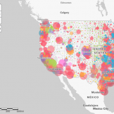
Placer County’s HMIS System Administrator Sue Compton needed to find a solution fast for the biannual January count of people experiencing homelessness, and a paper-based format was not going to cut it.

How can government agencies work smarter? For one, they can use geographic information systems (GIS) to increase effectiveness and management and go further by combining GIS with the Internet of Things (IoT).
At Esri Federal GIS, experts shared how ArcGIS reduces the time, cost, and efforts required of state and local governments to address operational needs.

It’s an exciting era for those in government. Vivid satellite images, airborne drones and 3D technology have unlocked another realm of possibility for public service.

Disease surveillance has long been important to preserving the health of people around the world, deterring outbreaks by monitoring the spread of disease and reacting as efficiently as possible. But what if the reaction could occur before the disease spreads at all? Geographic Information Systems (GIS) might be the key.