Today I tried out Street Bump – a mobile application designed and developed by Connected Bits, LLC and produced by the Mayor’s office of Boston. This application, available for the iPhone, picks up bumps in the road as people drive along a street with their phone. Because smoothness or “the ride” is one component we assess when we rate roadway condition, I thought it would be worthwhile test driving the application, literally.
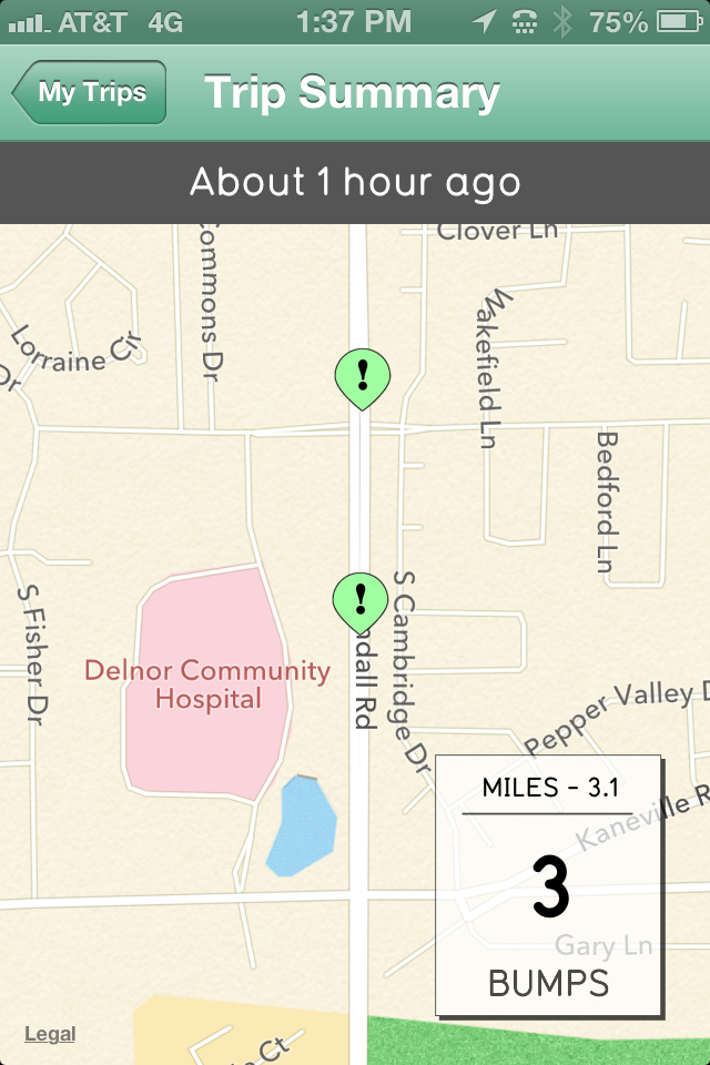
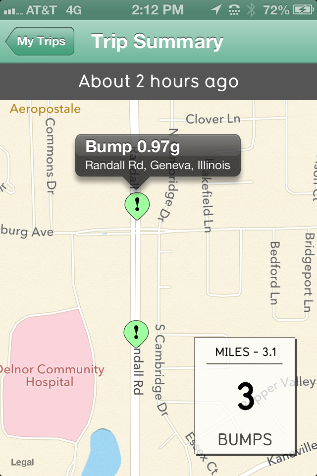
 So far, I only tested it on two trips, and here’s what I observed. My phone measured one bump on my first trip along 3.44 miles of mainly country roads and three bumps along 3.10 miles of the same route, but traveling in the opposite direction. The first bump on the first trip seemed to occur as we crossed the centerline to turn into a driveway and was plotted in an accurate location. On the second trip, I did not catch where the first bump showed up. The second seemed to occur when I switched the sound on while recording my trip, and it accurately plotted the location where I was when I did this. (I also want to mention I was a passenger on both trips.) The third bump occurred when we moved across a rough transition from a recent paving job onto the older pavement, but this one did not accurately plot. The bump had been in the westbound lane of a road we had turned left onto, but the map plotted it in the northbound lane of the road we had been traveling along before turning.
One feature I thought of right away that would be helpful is an indication showing me the roads where I have already driven. Right now, only bumps appear to be plotted. So if no bumps are recorded along a street, there is no documentation that I have checked that route and it is clear of bumps. It would also be helpful if I could delete specific bumps like the one that seemed to be caused by me turning my sound on. Currently the application only allows you to delete an entire trip.
 I did notice there seems to be a type of measurement of the roughness of the bump which is interesting. And while this could be useful in indicating the severity of the road condition, smoothness is only one factor engineers look at when rating a road. At work, we’ve been using the Pavement Surface Evaluation and Rating Asphalt PASER Manual to rate our roads. The method used in this manual considers cracking including the type of cracks, rutting, flushing, raveling, and weathering for example. Then a rating is assigned from one to ten with ten being the best based on the severity of these factors. Of course after establishing the rating, there are other elements to look at when choosing roads for repair such as traffic counts and funding.
To be fair to the developer, I don’t think they intended for the application to be used by engineers for rating roads. But since it was produced by a city, I was trying to figure out how a map showing bumps picked up by people driving through our town could be used by our city staff. One of the concerns I would have is if actions such as crossing a centerline, turning into a driveway, and changing the volume or sound settings on the phone causes a bump to be recorded, we could be wasting staff time sending people out to check out each bump. And I would be worried that people, or in some cities elected officials, might look at those maps online and contact us wondering what is wrong and why we are not doing something about the bump when perhaps the bump is not a true reflection of the road condition. But I could see how it would be useful to consult while we are out rating roads as one more piece of data to consider.
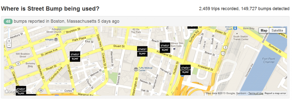
I’m curious to hear what other transportation professionals think of apps like this, and the expectations people have of their transportation agencies based on the output from these type of applications. Here’s the public map for Boston showing what has been recorded so far in the area shown.


We at Boston and Connected Bits eagerly read this post as we want as much feedback as possible from the road engineering community.
As your post alludes to, Street Bump is currently being used to find roadway defects such as potholes and sunk castings as opposed to evaluating the overall smoothness of a street. We’ve made great progress so far. For example, this Boston Globe article details how the city is finding and fixing problem castings Street Bump identifies: http://www.bostonglobe.com/metro/2012/12/16/pothole/2iNCJ05M15vmr4aGHACNgP/story.html
To respond to some of the concerns your post raised, our approach hinges on the ability to analyze large amounts of data. On the individual level, there are a number of variables such as GPS accuracy or differences in car suspensions that affect when and where a bump is recorded. Our initial research demonstrates that with large volumes of crowdsourced data, road defects stand out statistically. For example, we require a threshold of two or more bumps in the same location before an inspection is triggered. This threshold filters out most of the bumps caused by one-off actions such as accidentally jostling the phone.
To further increase the data’s usefulness, we are partnering with a professor specializing in machine learning and data mining in an attempt to distinguish different types of obstacles—say a pothole from a speed bump—through accelerometer data.
We also wanted to specifically respond to your comment about collecting trip data and its usefulness to measure road smoothness. To respect the privacy of Street Bump’s users, we decided not to collect that information. In the future, we may design a version of Street Bump specifically for city personnel that records trip data. That information would help us explore how Street Bump’s data can be used to create a road smoothness index similar to the International Roughness Index as well as to provide data to help our engineers determine the Pavement Condition Index for each street segment. We eager for ideas and suggestions on how best to do that.
We encourage those interested in Street Bump’s development to join our Google Group at: https://groups.google.com/forum/?fromgroups&hl=en#!forum/street-bump
James
I really appreciate learning how you are using this. Based on my experience with it so far, it makes sense that you would judge the accuracy of the reports based on the number shown in a specific area. And with the measurement capability, I could see how you could try to distinguish between the types of failures causing the bumps. That’s important because some cities would send out different crews depending on the type of failure.
With everyone’s concern over privacy, it also makes sense that you would be hesitant to record where someone had driven. Probably because I work for government I have so little expectation of privacy that I didn’t even worry about that for myself. But maybe this could be a feature that the user could turn on and off. That way the developer would not have to create a different program depending on the user.
I appreciate the link to the Google group and will definitely keep an eye out on how the app develops. Anything we can use to help us better assess the roads is a plus. Maybe you already looked into this or perhaps it doesn’t fit your goals for the app, but with the new MAP-21 focus on asset management, I wonder if there are grants available that you could tap into to expand the capabilities of the app to help us better manage roads.