
Combine smartphones, robots, and a little R.C. car action, then take the result to air and you’ve got drones.
Chances are, you’ve already been wowed by eye-in-the-sky drone footage. Perhaps you’ve been gobsmacked by the video showing the extent of the Nepal earthquake damage in Kathmandu or the one of the pro-democracy protests in Hong Kong. Or maybe you’ve simply delighted in OK Go’s music video filmed with a drone.
Also called unmanned aerial systems (UAS), unmanned aerial vehicles (UAV), remotely piloted aircraft (RPA), or sometimes model airplanes, these flying whirligigs are more than a new hobby obsession. Drones are the darlings of techies, inventors, creators, and engineers, who are imagining them as more than just flying video cameras.
As computer hardware has reduced in size and drone design has evolved, builders have been able to put all sorts of technology on board these small unmanned aircraft. This means that drones are ever more adaptable and useful, and so are being deployed in a variety of new ways. Leaving aside the recent security problems involving drones and their sometimes controversial uses by military and in national security, government has used drones for some other important aerial tasks.
Here are just some of the cool ways that government agencies have put drones to work:
Nature’s Peeping Toms
While consumer drones are currently banned in national parks to protect wildlife and visitor experience, for over a decade the government has embraced using drones out in nature for the right purposes.
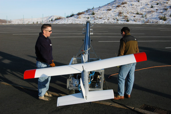
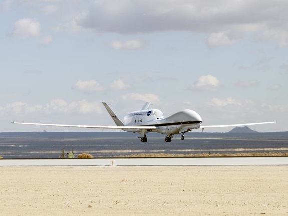
The U.S. Geological Survey (USGS) has been using drones to venture into the danger zone since 2004, when it sent them buzzing over the rumbling Mt. St. Helens. Drones are still used to explore areas hazardous to humans, analyze ash plumes, track lava flow, and monitor for subtle changes in gas levels that can signal a potential volcanic eruption.
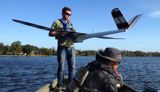
The National Oceanic and Atmospheric Administration (NOAA) has left the deck and watches the seas from up high. The agency believes that drones will “revolutionize” its ability to monitor the global environment by “bridging the gap” between lowly earth-bound stations and lofty satellites. The agency is pioneering drones in the field, from capturing the unmanned aircraft by net to gathering data from the dangerous heart of a hurricane to identifying river turtle habitat.
Remote-Controlled Disaster Relief
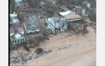
Drones and disaster relief were an early match. After Hurricane Katrina hit hard, a National Science Foundation (NSF) research center deployed drones in Mississippi to find survivors. The drones were able to reach where rescue teams couldn’t, using thermal imaging to locate people in the disaster area.
When disaster strikes, communication is key to keeping people safe and getting safety teams where they need to be. An NSF-funded researcher has developed drones that can keep wireless phones working when cell service fails. Meanwhile, the FAA is working with drone manufacturers and civilian groups to allow them to operate drones in local search and rescue missions.
The U.S. Department of Transportation (USDOT) is also hard at work supporting research and fieldwork to map transportation infrastructure both before and after a disaster. The USDOT is confident this will allow engineers to more easily identify infrastructure damage if there is a historical image to compare it to.
Beyond Voyeuristic Climate Change
Many government agencies increasingly rely upon drones in the race against climate change. NOAA’s Pacific Marine Environmental Laboratory is using drones to measure soot in the Arctic to evaluate how its presence impacts the climate.
NASA has also employed drones to better measure fluctuations in the atmosphere to improve global climate change forecasts.
To bring greater efficiency to research in rough terrain, a USGS study has also put some of its geothermal and seismic fieldwork up in the air.
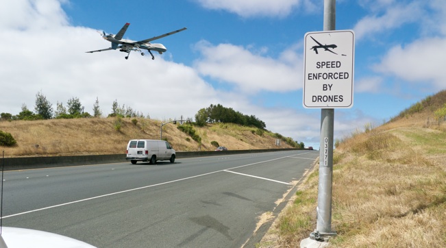
Keeping an Eye on the Road
You may have seen the signs along the highways: SPEED ENFORCED BY DRONES. While those signs were actually a clever guerrilla art project by Stephen Whistler (the real ones say “Speed Enforced by Aircraft”), the idea isn’t that far from reality.
Spying on speed demons is just the most obvious (and creepy) way to use drones in transportation. Under a grant from the Federal Highway Administration and the Georgia Department of Transportation, Georgia Tech has been studying drones for highway construction, safety, and maintenance and keep traffic moving safely.
The benefits? “Drones could keep workers safer because they won’t be going into traffic or hanging off a bridge. It would help with physical limitations of the human when doing this kind of work,” explained a director at Georgia Tech.
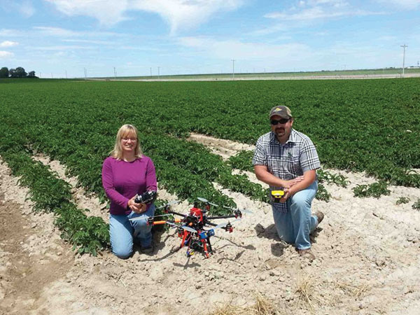
Liftoff for Land Use
The U.S. Department of Agriculture (USDA) has been using drones to watch the corn grow as high as an elephant’s eye. Well, corn and also potatoes and other experimental crops like those used for biofuels.
These drone experiments are helping the USDA identify ways to maximize crop yield, spot crop problems early, reduce production costs, and improve real-time crop forecasting.
No Drone Zones
Whether you’re piloting from a cockpit or on the ground, FAA policies regulate drone flights and recently proposed a loosening of the regulations for commercial drone flights. NASA is also working on a low-altitude airspace or “highway in the sky” management plan, but that’s expected to take 10 years.
In the meantime, if these clever uses of drones have inspired you to incorporate drones into your agency’s work, check the regulations where you plan to fly.
Lauren Girardin is a marketing and communications consultant, writer, and trainer. Find her on Twitter at @girardinl.


Leave a Reply
You must be logged in to post a comment.