
![]()
Many people around the world use GIS every day. It is in our maps, apps, and our photos are now tagging locations. Do you know how often you use GIS? It’s used for Yelp, directions, Google, finding restaurants, data analysis, finding a home, many phone apps and more. With the advancements in technology, there has been an explosion of new GIS tools and applications.
When I was introduced to the world of GIS via ESRI’s ArcMap, I was excited and amazed at the technology. This program allows the user to create, edit and analyze GIS data. It combines imagery and data tables. Now it seams we are using GIS everywhere. So what is GIS? Simply defined it is a Geographic Information System. This system has “gone viral” and reached into every corner of the world. It is a tool for decision making, record keeping, communications, management, disaster recovery, education, and so much more. As this technology grows I see it reaching into every industry and occupation.
How does GIS effect our world? We live in a wild world with many adventures, disasters, challenges and opportunities. Let’s look a little deeper into how:
ADVENTURES
We look into the news and we see GIS touching everything. We use our Garmin, MapQuest, Google etc. for directions, to recreation, from trip planning to government. You can read how Route Sequencing gives the City of Woodland leverage and saves them time and money.
Maps and apps for your next adventure are abundant. Just take a look at some of the fun with geocaching sites and apps like https://www.geocaching.com/play,
One of my favorites are the story maps. These kind of sites alone can bring you on world adventures right from your desktop.
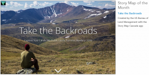
Backroads
DISASTERS
GIS is used in many of the industries to determine the scope of a disaster. It helps make assessments, recovery plans, planning, and resource allocation. With remote sensing tools analysts can see real-time information over areas and time. Time-Aware Functionality, Data Integration, and Remote-Sensing Image Comparison can bring disaster decisions to the fingertips of emergency personnel.
http://www.esri.com/news/arcnews/fall11articles/disaster-decision-support-system.html
http://www.unavco.org/software/visualization/GPS-Velocity-Viewer/GPS-Velocity-Viewer.html
Public Safety uses GIS tools in many areas. Here are some links to ESRI pages – Dispatch, Disaster management, Situational Awareness, US Hazards Overview
Story maps also can help us understand what and where in the world things are happening. This story map of 2016 Terrorist Attacks I found interesting. http://storymaps.esri.com/stories/2016/terrorist-attacks/
CHALLENGES
Developers and analysts are using and creating tools to solve problems every day. I created an App with the help of the ESRI templates to help our county’s workers track assets in the field. Many counties have improved their record keeping and access to data. http://www.esri.com/news/arcnews/summer11articles/the-big-sky-state-finds-gold-in-statewide-cadastral-database.html
Improved Communications – http://www.esri.com/news/arcnews/spring08articles/michels-corp.html
OPPORTUNITIES
GIS can make every student smarter, every worker more efficient, every position more valuable. We can see an inventory program that you can click on a list and it takes you to the map where the inventory is. If is it a floor plan or a map of the country, being able to see where your assets, staff, resources are is a truly valuable tool. It is the crimes analyst that can put a map of the violent crimes in the last week color coded by time, or the real-estate agent that can map available business locations by proximity to other large commercial complexes. There are new tools, apps and websites being created every day. If building apps sounds like fun check out https://developers.arcgis.com/. Story Map Crowdsource. https://storymaps.arcgis.com/en/app-list/crowdsource/
As GIS moves with this next generation we will continue to see great applications like Google Earth Pro., ArcGIS Explorer, ArcGIS Online bring our data to life. There are so many options to work and play with. ESRI as the leader of the GIS world has so many great opportunities and adventures http://www.esri.com/esri-news/maps . Programs that now use GIS like AutoCAD, dispatch software and more are bringing these tools into their software. I hope you take some time and explore what GIS can do with your data.


Leave a Reply
You must be logged in to post a comment.