Transform Communities Using Geospatial Solutions
To advocate for healthy, safe and vibrant communities, the Institute for Public Strategies created a five-prong strategy, all of which use GIS to achieve efficiency and effectiveness.


To advocate for healthy, safe and vibrant communities, the Institute for Public Strategies created a five-prong strategy, all of which use GIS to achieve efficiency and effectiveness.
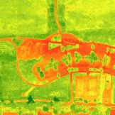
Salem, Oregon’s drones-as-a-service program supports multiple city departments, enhancing operations through high-resolution imagery.

Carlsbad, California’s approach to economic storytelling, based on geospatial data, is a blueprint for how local governments can use the tools they already have to build the communities they envision.

GIS and public health go hand-in-hand in creating healthy and safe communities. Public health professionals can use a number of basic GIS tools to enhance their work.

Nashville, TN, is growing fast, and that’s led to transformative projects. Here’s how a GIS system helps it stay ahead of change.

Government agencies are using data to assist with workforce management, performance measurement, and resource planning. Here are the details.

Portland used a mobile GIS solution to address homelessness while providing information to the community via online dashboards.

In Kansas, the Overdose Response Strategy team leveraged GIS to combat the substance misuse health crisis.

Mapping and data analysis help Raleigh, NC, respond to emergencies and plan for the future. Learn how geographic information systems can improve city services.

Geographic information system (GIS) technology is an invaluable tool for state and local traffic and emergency management.