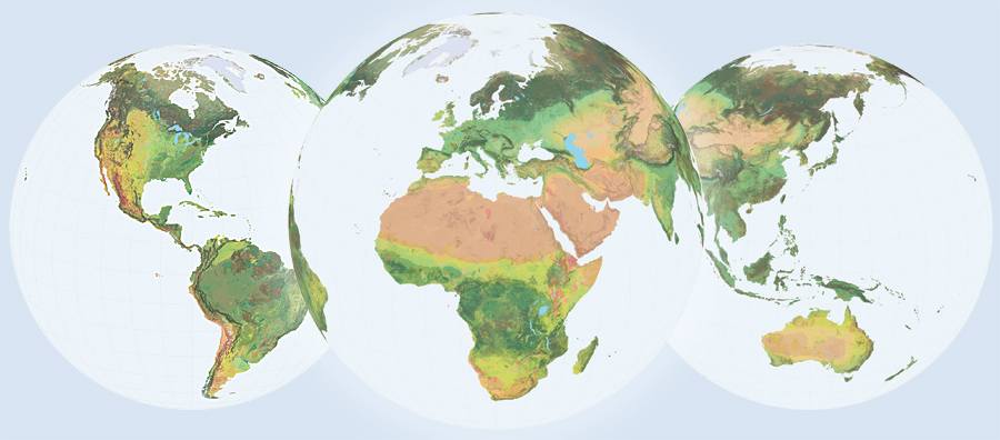
Esri is a company that strives to create products that will better the world. Their most recent accomplishment is called: the Global Ecological Land Units (Global ELU) map. This new technology co-created with Roger Sayre of the US Geological Survey (USGS) is meant to help users see the world in a new organized way while providing new geographic patterns and relationships. Land planners, resource managers, conservationists and scientists will be presented with better platforms to build their maps that will help change the world.
This new mapping system advances the notion of open data by providing readily available data layers that encompass four environmentally important concepts: landform, climate, rock type, and land cover. GIS technology is utilized across the globe to aid governments in policy making therefore Esri is attempting to create a common language in mapping. A common platform will allow for users to compare variables anywhere on the planet.
The formation of Global ELU started in 2013 using 250-by-250 meter grids that consist of 3.5 billion cells. 47,000 distinct categories were identified as “ecological facets”. They were compressed into the simplest, meaningful set of groupings that work as the source data for the maps. The maps have revealed significant data such as where the more ecologically diverse regions of the world are located.
Esri recognizes that environmental problems affect everyone. Users of Global ELU will be able to make more substantial policy decisions that benefit the whole world. Ecological, social, conservation, and climate change assessments are just a few examples of what can be generated with this new technology.
Esri is not stopping there. They are continuing their public-private partnership to enhance spatial geographic science, cloud computing, GIS processing, and spatial and statistical analysis to generate one single dataset for the mapping platform. Global ELU is a call to action for government workers to collaborate, think innovatively and utilize their resources in the best way possible. Maps and open data do have the potential to change the world for the better.


Leave a Reply
You must be logged in to post a comment.