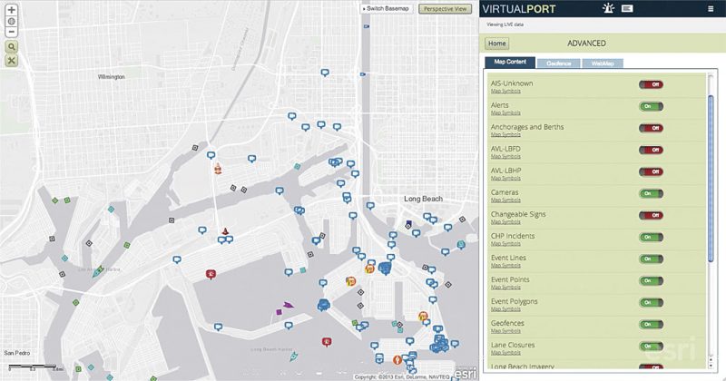
This blog post is an excerpt from our recent report with Esri, Creating a Real-Time Government with GIS. To download the full report for free, head here.
A connected government participates in the creation and maintenance of data and real-time information. They move away from creating siloed smart projects and set up a true real-time infrastructure that can ingest, collect and analyze real-time data.
Luckily, modern technology provides today’s agencies with the opportunity to transform their organizations. The availability of real-time data can help them respond to incidents sooner and excel in the face of chaos.
However, consuming this massive in flux of data without a system to capture, analyze and process it into actionable information will leave agencies buried under a pile of raw content. Esri’s GIS technology uses location data and provides
the tools that enable you to instantly see what is happening, identify where it is happening, understand why it is happening and share all that information with those who need it.
5 Steps to Take to Real-Time Government
- Build key maps: Your operations are based on locations. Having access to relevant organizational maps provides location-based reference points. GIS should act as the system of record for all the location data in your organization.
- Connect IoT data: Real-time data, such as that coming from IoT sensors and devices, is streaming into your organization. Connecting the appropriate mission-based data to your mapping platform helps filter out noise and enables you to understand situations quickly and focus on what’s happening in critical areas.
- Analyze data in real-time: GIS is the ideal tool to visualize, analyze and make sense of IoT data. Location analysis can identify hot spots of activity and relay them back to your organization’s resources. Quickly determine where events are developing or threatening citizens or employees so that you can rapidly respond.
- Share information: Decision-making occurs across your organization. Make sure that decisions are based on timely, reliable and up-to-date sources of information. GIS, with streaming real-time data, enables you to communicate that information to decision- makers freely, easily and automatically.
- Organize and decide: With the appropriate analysis of data and access to information, everyone in your organization is equipped with the support they need to make accurate decisions and respond to fluid conditions. You can more effectively protect life and property, execute your missions, and reduce confusion during critical operations.


Leave a Reply
You must be logged in to post a comment.