
In Montgomery County, Maryland’s wealthiest and most densely populated municipality, planners are contending with a challenge facing so many other areas of the country: where and how to grow.
“Increasing housing production is one piece of the affordable housing puzzle,” said Chris McGovern, GIS manager for the Montgomery County Planning Department’s Information Technology & Innovation division. “Our county is exploring how to sustainably integrate and encourage more—and more diverse types of—housing, particularly along transit corridors, near activity centers, and through infill and redevelopment.”
Longtime innovators on housing and land development policies, Montgomery County’s leaders are guided by their Thrive Montgomery 2050 plan. It prioritizes the dense, sustainable housing and transit-oriented development McGovern noted as well as racial equity and climate resilience.
To ensure those goals are incorporated in future developments and to keep up with changing demographics and housing demand, the county’s planners have created a digital twin using the latest geographic information system (GIS) technology.
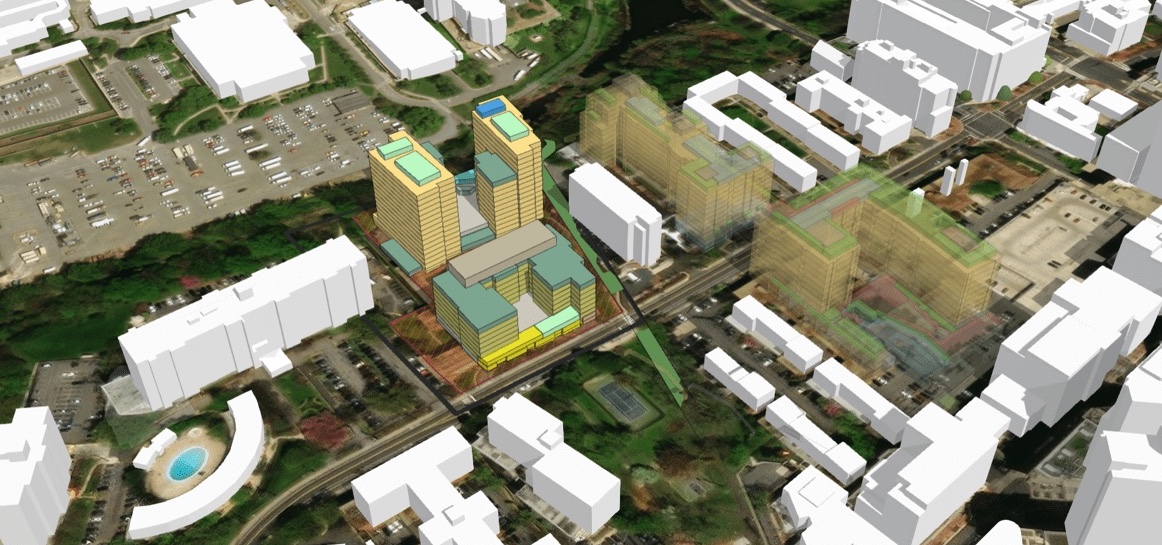
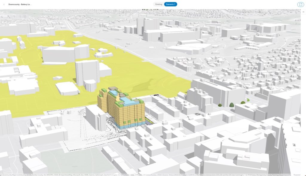
Staff can combine 2D drawings and documents to generate iterative, interactive 3D models with a GIS-powered urban planning application called ArcGIS Urban. They add layers such as building footprints and property lines to give the model more spatial context. Planners and stakeholders can access the model online to get a quick visual representation of proposed projects instead of looking through dozens of documents.
“The ability to create these amazing models that you can fly around and see in relation and in context to the surrounding built and natural environment is incredible,” said Jay Mukherjee, the planning department’s principal GIS specialist.
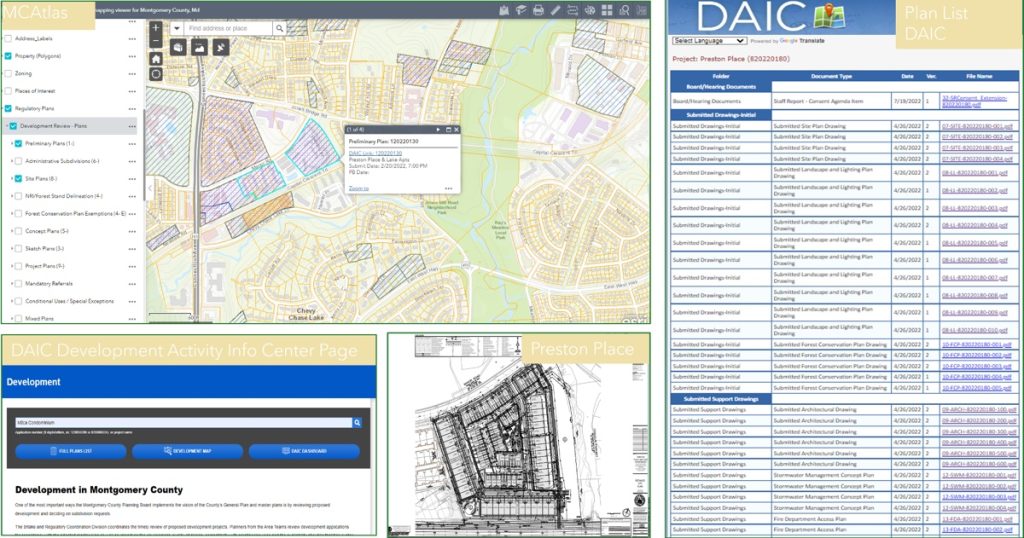
The county has incorporated data from its Development Activity Information Center, which indexes project descriptions, maps, and drawings. All of this data lives in the county’s digital twin, giving developers an accurate picture of potential areas of opportunity as well as an easier way to check the impact to land use changes.
Mary Beth O’Quinn, an architect and urban planner with the Montgomery County Planning Department’s Information Technology & Innovation division, said the ability to quickly check that proposals meet all the required statues, zoning, and building regulations has transformed her work.
“The models distill the required elements of the proposal—green space, open space, pedestrian and vehicular circulation, parking, number of units, densities, and building height—and display the essential elements approved by the planning board,” she said.
Recently the county used ArcGIS Urban to build a 3D model of a proposed 10-story luxury apartment building south of the National Institutes of Health’s 300-acre Bethesda campus. The new development will offer more housing than the postwar three-story apartment buildings it’s replacing. A 3D view revealed how walkable the future project would be, with restaurants, a park, small businesses, as well as bus and metro stops, all within a 10-minute walk.
As new projects like this one are added to ArcGIS Urban, they will be shared on the planning department’s ArcGIS Hub site.
“It’s our responsibility to convey the work we’re doing in a digestible way to the engineering and architectural communities and the residents who are getting these things built next to them,” he said.
Learn more about how planners use GIS for urban and community planning initiatives and economic development.
Christopher Thomas is the director of government markets at Esri and a founding team member of the Industry Marketing Department. Prior to joining Esri in 1997, he was the first GIS coordinator for the City of Ontario, California. Thomas frequently writes articles on the use of GIS by government.
Images courtesy of Esri
This story originally appeared on December 1, 2023, and was featured on Esri Blog.


Leave a Reply
You must be logged in to post a comment.