Storytelling is a fundamental part of our culture. Through images and narrative, any story has the ability to captivate an audience. Esri took this concept and elevated it to another level through ArcGIS Story Maps.
Story maps combine interactive and multimedia components to fully engage audiences in their map’s content. Government agencies across the world have utilized story maps to provide critical information to the public in a user-friendly way. Most recently, Esri used government data to produce three interactive story maps that display real-time information on the Nepal Earthquake to the public.
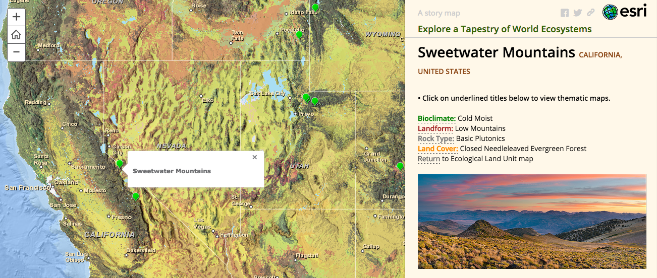
Technology is rapidly growing while threats to our welfare continue to evolve. The United States Geological Survey (USGS) and Esri utilized story map technology to publish a global ecosystems map that informs the public on essential information regarding the world’s limited resources. Global resource management, planning and decision-making have improved worldwide with the use of this new knowledge tool.
Not only does this story map provide, for the first time ever, a web-based interactive tool for conservationists, land developers, and government workers to analyze, but it also advances the utilization of big data. Esri was able to layer massive amount of data while making objective, meaningful distinctions between several data sets.
Enough about Esri’s successes, the geospatial information systems company wants to see what YOU have accomplished. Has your agency developed a story map that has made a significant impact on a large audience? Esri is inviting you to submit up to three preexisting or new maps to their Story Map Contest.
There are five categories that each will be awarded a first, second, and third place winner. One grand prizewinner will be awarded with the title of Best Overall Story Map. The categories include:
- Travel/Destinations/Recreation
- Infrastructure/Planning/Government
- Science/Technology/Education
- Culture/History/Events
- Conservation/Environment/Sustainability
The prizes are listed below:
- Grand Prize/Best Overall: A one-year ArcGIS Online subscription for five users plus a plaque and a certificate
- First Prize: A GoPro camera plus a plaque and certificate
- Second Prize: A copy of the Esri Press book Cartographica Extraordinaire: The Historical Map Transformed plus a plaque and certificate
- Third Prize: A copy of the Esri Press book Cartographica Extraordinaire: The Historical Map Transformed plus a plaque and certificate
The judges will be looking for maps that have a lasting impact on their viewers. Creativity and passion are vital to telling a great story. Esri is looking for maps that exude these elements while serving a fundamental purpose for the public. YOU can be the next person to make a significant difference by creating and sharing a story map.
To learn more information about this competition and enter a map you can click here. The deadline for submissions is June 8, 2015. For even more story map knowledge, attend their seminar- Telling Your Story with Esri Story Maps on Thursday May 7, 2015. Also, be sure to register for the GovLoop-Esri Meetup on May 21, 2015 at the District Architecture Center in Washington, D.C. to network and hear best practices from story map experts.


Leave a Reply
You must be logged in to post a comment.