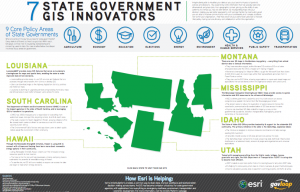
Imagine being able to visualize your data so you could see the impacts of potential policies and decisions. You could bring to life information that has typically been one dimensional, and place data into a geographic context, giving you the ability to see patterns and trends you had not seen before. By incorporating maps into your decision-making, you are better equipped to craft policies that do the most public good; you are able to improve communication with your constituents; and increase collaboration within your organization. Hear how seven of your peers have used GIS to improve their policy making, service delivery, and collaboration within the organization.