
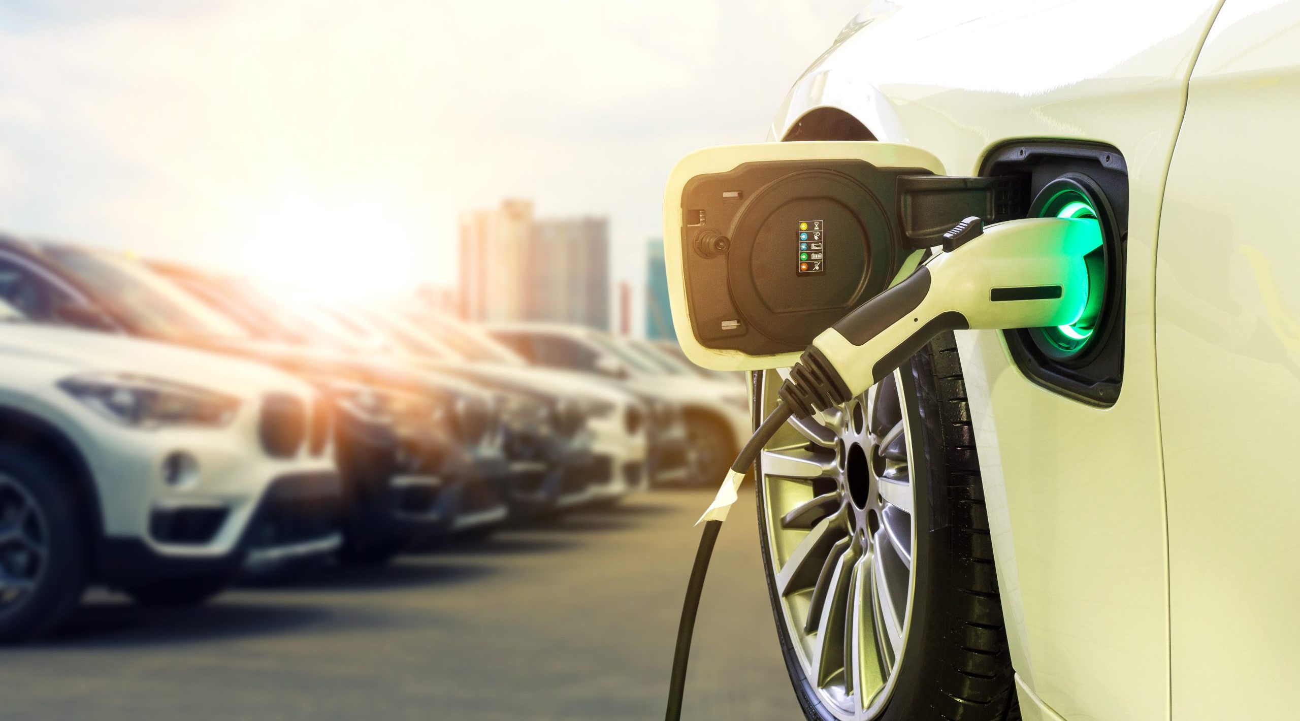
As electric vehicle (EV) use grows, planners and policymakers need to know where to build charging stations to accommodate drivers and encourage adoption — and do so equitably.
Increasingly, government leaders are turning to data-driven maps and location analysis to better position chargers in their communities. With this location intelligence, they can see where current EV owners live, where charging stations already exist, and where new charging stations will need to be positioned to support EV growth.
Until recently, EVs were mostly bought by higher-income homeowners with garages where they could charge their cars. As the US Department of Energy estimates, 80% of EV charging happens at home. Though affordable base model EVs have expanded consumer reach, a lack of accessible and dependable public chargers discourages many from driving cars. For instance, apartment residents may not have access to overnight chargers.
EV Charging Build-Out Is a Location Challenge
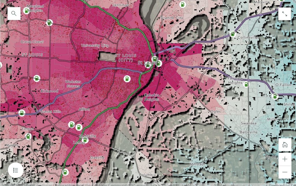
In California, a state-funded organization partnered with a Los Angeles-based engineering firm to develop a site-suitability application for EV charging stations. The location-based tool, built using geographic information system (GIS) technology, integrates multiple data streams onto maps and dashboards so people can visualize a community down to curb level.
Planners can see all relevant data — including demographics, pollution rates, government funding requirements, and electric grid capacity — in context of location to consider variables that otherwise may have been missed. They can identify, for example, where best to place accessible chargers near residents for safe overnight charging or for a fast charge so drivers can travel with ease.
Policymakers also can use maps to seek Justice40 funding for their EV infrastructure projects. The initiative dedicates 40% of federal investments to communities that have been disproportionately affected by environmental pollution and a lack of access to clean energy resources. The Disadvantaged Communities (DAC) map layer, created by the US Departments of Transportation and Energy, matches Justice40 criteria with census tract data. With this data and other indicators like multi-unit housing and DMV-registered vehicles, policymakers can prioritize EV charger installation in disadvantaged communities.
Getting From Point A to Point B Without Worry
Equally important to charging at home is a driver’s ability to charge while traveling long distances. Whether traveling on city streets, neighborhoods, or interstate highways, many drivers experience range anxiety — the fear their vehicle won’t have enough charge to make the trip.
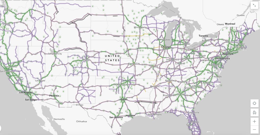
GIS can help planners strategically position EV chargers along freeways, helping to curb range anxiety while maximizing funding for interstate freeway projects. Smart maps can show high-traffic routes along with current charging stations to identify where additional ones are needed. Using GIS, planners can verify whether those routes correspond with designated Alternative Fuel Corridors (AFCs) and input locations of interest like rest stops, hotels, and tourist sites to determine where drivers might stop long enough to charge up.
As promising as electric vehicles are in emitting far less harmful carbon emissions, it’s wealthy communities that have benefitted to date. Wider adoption will require a well-developed, accessible network of EV chargers. Policymakers and planners can use GIS maps to target some of the $7.5 billion in federal funding through 2026 to build out a network of charging stations in a way that is practical and equitable.
Learn more about how state and local governments can map federal funding targets for sustainable infrastructure.
Christopher Thomas is the director of government markets at Esri and a founding team member of the Industry Marketing Department. Prior to joining Esri in 1997, he was the first GIS coordinator for the City of Ontario, California. Thomas frequently writes articles on the use of GIS by government. Follow him on Twitter @GIS_Advocate.


Leave a Reply
You must be logged in to post a comment.