

Every year, volunteers fan out across the US for a point-in-time count of unhoused residents — work required by the US Department of Housing and Urban Development and critical for federal funding support of homelessness services. In Los Angeles County, the process looked different this year. Several thousand volunteers and staff used real-time maps and location data collection apps to record observations across the county’s 4,084 square miles.
“We were able to, at any given time, identify which Census tracks were being completed and which were not,” said Emily Vaughn Henry, deputy chief information officer for the Los Angeles Homeless Services Authority (LAHSA).
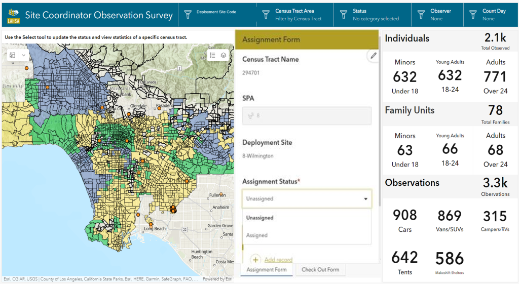
Field data input on mobile apps was automatically synced to a dashboard in the county’s command center. The work — from county maps to data collection apps to a live dashboard — was powered by geographic information system (GIS) technology.
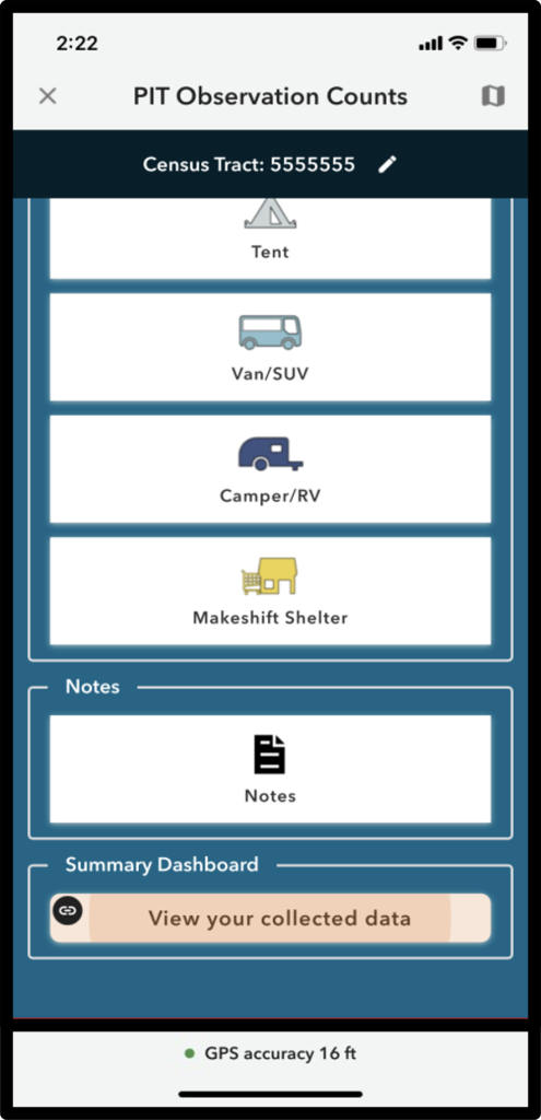
Six months ahead of the annual count, Vaughn Henry and her team at LAHSA worked with GIS to customize a mobile application. It would allow volunteers to capture field observations using a tablet or smartphone while they walked or were passengers in a moving vehicle.
This modern approach meant staff could spend less time manually processing data collected on paper forms (although paper forms were offered as a backup). It also made results quickly available to view on a dashboard for shared situational awareness. Visualization via maps showing county boundaries along with locations of volunteers helped reduce double counting of people experiencing homelessness.
Making Progress to Map the Homeless Crisis
In a large county like Los Angeles, determining the number and geographic extent of unhoused people is challenging yet essential to address needs and plan targeted services.
Based on this year’s data collection, LAHSA estimates that 75,518 people experience homelessness on any given night in the LA county, up 9% compared to the year earlier.
The teams of volunteers and staff recorded their observations for 2,967 out of the 3,193 census tracts over three nights in January 2023. In 2022, LAHSA had to recount almost 1,500 census tracts. This year, using the GIS app, they only had to recount 129.
“To me, that’s progress,” said Vaughn Henry who was invited to present on the project at the 2023 Esri CIO Summit.
The GIS-powered data collection application contributed in large part to the success of this year’s count. Staff and volunteers were able to adapt to the new technology to successfully collect and upload the count information.
Vaughn Henry sees the potential in mapping even more key information to inform homeless services. This includes collecting data on every shelter in Los Angeles County and the available beds as well as identifying the locations of every encampment, how many people live there, and where they move to.
“We can leverage technology to identify individuals and actually get a true count of individuals who are experiencing homelessness,” she said. “How do we do that? I’m a big fan of geolocation.”
Learn more about how GIS can help in identifying where the people experiencing homeless live in order to better offer services to help.
Christopher Thomas is the director of government markets at Esri and a founding team member of the Industry Marketing Department. Prior to joining Esri in 1997, he was the first GIS coordinator for the City of Ontario, California. Thomas frequently writes articles on the use of GIS by government.


Leave a Reply
You must be logged in to post a comment.