
It is easy to say that the nation’s water resources are interconnected and that what happens upstream can have major consequences for downstream areas. But it is much harder to convey these points in a relevant way to a nation of city-dwellers. However, cartographer Daniel Huffman has found a new and refreshing way to show how interconnected our rivers are, and thus how careful we should be in protecting them. Below is Huffman’s transit-style river system map.
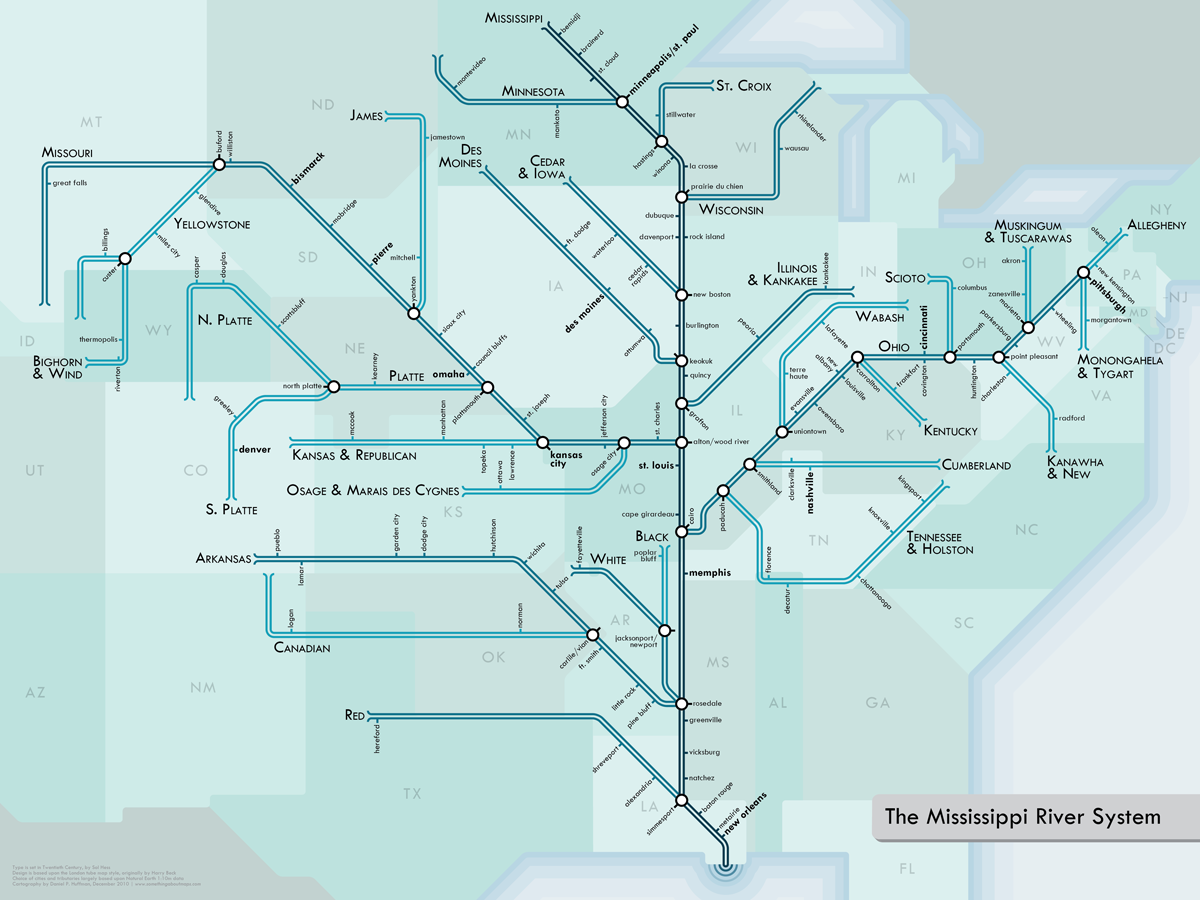
It’s not every day that we come across a new way of looking at the nation’s water resources. This map, though, caught our eye not only for its visual appeal. It reminded us how vital – and interconnected – river systems are. After all, water that enters the Gulf of Mexico may have come from New York or Montana.


Leave a Reply
You must be logged in to post a comment.