
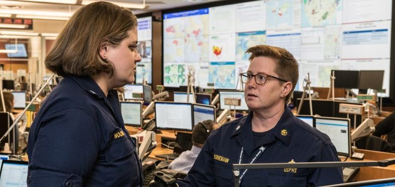
We can all recognize that the role geography plays in executing an effective public health response is critical. This truth became more prevalent through the dashboards displayed by organizations such as John Hopkins University, the news media, and national, state, and local governments during COVID-19. Location provided context at a more personal level, helping people nearby understand the disease’s potential impact on them.
Understanding how to apply location-based thinking enhances preparedness and response efforts. GIS offers the opportunity to scale standard operating procedures; implement new response and recovery applications; engage with the public; and collaborate across organizations. Communities can also maximize resources using GIS, whether they are responding to a toxic spill, extreme heat waves, natural disasters or pandemics.
GIS makes it possible to answer the question of “where.” Here are four key areas in which location supports public health preparedness plans:
1. Decision Support
The key to using location intelligence is to build it into the public health emergency preparedness plan from the beginning. When you start developing your preparedness plan, assess your data: Do you have existing systems that collect important data in real time? Can you add interoperability to connect disparate systems for a more functional and consistent common operating picture? And more generally speaking, consider how location can enhance the data you’re collecting, so that you can add visualization from the start.
Data-driven decision-making is about using data to answer fundamental questions needed to inform response and management efforts. GIS is crucial because so many questions hinge on location data.
2. Resource Allocation
The key to a high-impact recovery plan is having the right resources in the right place at the right time. GIS can optimize resource allocation by placing resources precisely where they are most needed. For example, this is particularly important when identifying the closest facilities to an event, determining options for temporary facilities, or identifying quantities of supplies needed by neighborhood.
Location supports the distribution of resources at the intersection of people and need. GIS can dive even deeper by contextualizing lifestyle and socioeconomic conditions in affected areas. For example, understanding whether people have vehicles or ride public transit lets preparedness staff know whether a drive-thru facility is enough or whether organizations need to bring services directly to the neighborhoods.
3. Communication and Collaboration
No matter how large or small the health response is, situational awareness is critical. Every health crisis requires support from a wide variety of disciplines, including emergency management, law enforcement, human services and health care. Those stakeholders need a common operational picture of what is happening and where so they can communicate and collaborate effectively.
Understanding how the response is unfolding provides the opportunity to identify where your resources are, ground truth information as it becomes available and pass the information directly to operational dashboards. Users can import resource data into models and machine learning tools. They can also deploy staff to the places and populations that need support most.
Every health emergency requires informed decisionmaking to minimize impacts to the environment, infrastructure and people. GIS supports a range of communication and collaboration efforts. Once the base location data in the emergency operations center has been established, organizations can feed insight into managing the event.
4. Civic Engagement
Civic engagement can take on many forms before, during and after a health emergency response. Location provides context for an emergency that offers a more intuitive approach for public engagement. The more people understand the effects of the crisis in relation to where they live, work and play, the more engaged they become. The public can begin to understand the larger picture of how the crisis affects their family, friends and coworkers, in addition to the larger community.
GIS can support public education through storytelling with maps, public notifications and public input. The response to the COVID-19 pandemic demonstrated how location supports the full range of civic engagement activities. These engagements can be used at any time during the event, from the initial response to economic recovery.
This article is an excerpt from GovLoop’s recent report, “Strengthening Public Health Preparedness With GIS.” Download the full report here.


Leave a Reply
You must be logged in to post a comment.