This blog post is an excerpt from our recent industry perspective, High-Resolution Imagery: Helping City Managers Better Serve Their Communities. To read the full piece, head here.
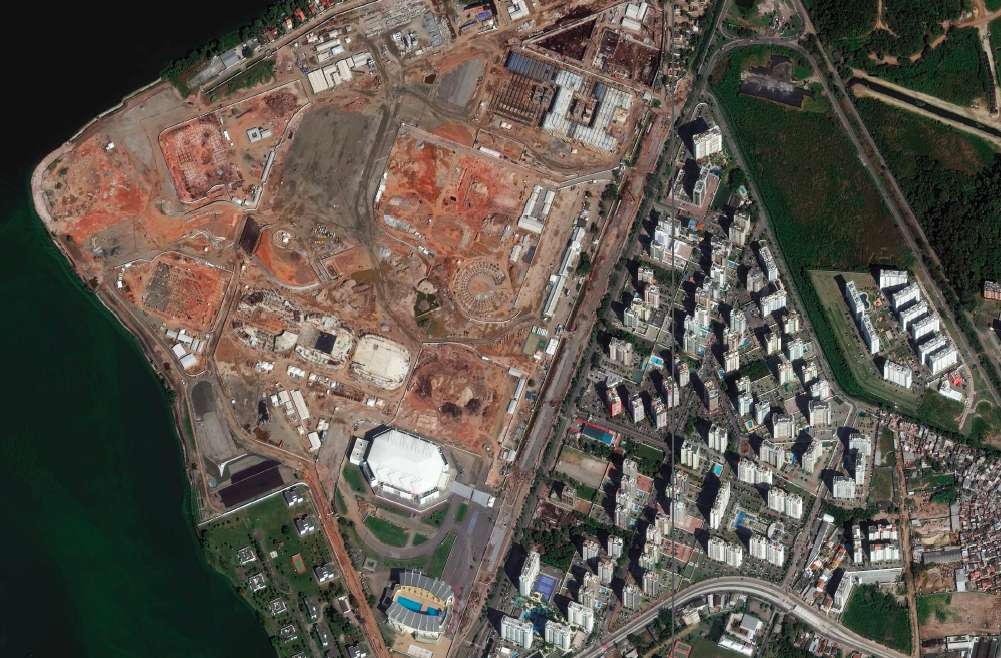
To make informed decisions confidently, city managers need the full picture. This means access to highly detailed, highly accurate and frequently updated imagery.
Space technologies can map an entire metropolitan city and keep the information up-to-date. During a disaster, this can mean providing daily updates to accelerate emergency response and track recovery. For day-to-day city maintenance operations, highly accurate satellite imagery and derived information on a manager’s desktop means greater efficiency in the field. For example, it helps determine the best manhole for their field workers to use when accessing a sewer in need of repair to speed the identification and repair process.
Historically, obtaining recent imagery of a city has been a challenge. For a large metropolitan area such as Shanghai, it could take weeks to collect data and another month or two to produce usable, actionable datasets. Further, to obtain this imagery, city managers would have had to issue a tender, or request for proposals, while often spending $30,000 to $40,000 of taxpayer money to prepare it. Satellite imagery can collect the same type of information much faster and provide the data within days. Additionally, because these products can now be ordered off the shelf, city managers avoid an expensive procurement procedure.
Removing barriers to entry
Traditionally, cities have faced four main obstacles to obtaining high-quality geospatial imagery: licensing, acquisition, ease of use and the need for a specially trained workforce. New approaches and technology, however, are making it easier for cities to modernize their systems.
Barrier 1: Licensing
Many cities have limited access to imagery and rely on Google Earth or other photographs that are often outdated but freely available online. But these photos have traditionally had a licensing model that was built for specific applications and had restrictions on use that prevented city managers from customizing the data for their particular needs.
Now, however, getting access or upgrading to high-quality imagery is becoming easier—and cheaper—thanks to faster processing and automated analytics. The licensing models are evolving to include lower cost barriers and fewer usage restrictions. Leveraging these technologies helps city managers solve many problems that require a reliable, detailed view of the ground. For example, they can settle disputes over boundary lines or ensure appropriate property taxation.
Barrier 2: Acquisition and speed
In the past, cities used a model of service-level agreements in which they had to secure a set of bids for imagery over a set period of time. Managers overseeing a 10,000-square-mile metropolitan area would split the region into quadrants and collect imagery information on one quadrant per year to stay on budget.
Now, city managers have affordable options for accessing imagery and gaining a better understanding of change on a frequent basis. Current and historical geospatial information is available through online subscription models that are more economical than the tender, or bidding, process. Subscription models also give cities the flexibility to periodically refresh that information.
The speed at which data is available has increased, which makes it not only more useful, but also more accessible. It used to take months for an imagery provider to deliver data to end users; it now takes minutes. With new technologies, city managers can have a complete assessment of damages within hours of a disaster, so they can appropriately assign resources and better serve citizens in need.
Barrier 3: Ease of use
Imagery datasets are typically very large, making them potentially cumbersome to download and use. In the past, cities had to invest in resources for ingesting, accessing and storing all of that data. Now, options such as hosting the imagery online allow city managers to spend less time and money gathering, manipulating and storing data, and more time using it to solve real-world problems.
Imagery is typically served in open standard formats, which allows for integration into a city’s GIS and public websites for sharing with citizens. Today’s data analytics quickly process and share the information online, which eliminates the need for state and local information technology teams to invest in so much equipment. It also means that governments are not receiving large amounts of data that someone must manipulate before it is useful. Shapefiles—an easily sharable data format for GIS software—and maps show all the detail city managers want and need.
Barrier 4: Need for specially trained workforce
Historically, cities needed specially trained individuals to analyze geospatial data. As recently as five years ago, cities required several resources, including GIS software, robust IT infrastructure and a tech-savvy workforce, to manage the geospatial technology required to work with this heavy data.
Now, geospatial technology providers are taking responsibility for ensuring data quality, so that city managers—rather than GIS specialists—can trust the data and start using it right away in day-to-day operations.


Leave a Reply
You must be logged in to post a comment.