
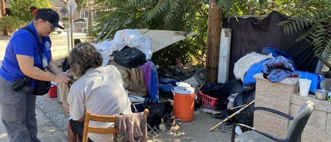
In the agricultural city of Modesto, California, east of San Francisco, people experiencing homelessness can be seen in over-crowded temporary camps near bridges, highways, parks and other areas. A recent point-in-time count of unhoused residents in Modesto’s Stanislaus County reported nearly 3,000 people, including more than 200 children.
Responding to the crisis, Modesto officials aimed for faster delivery of services and took a geographic approach.
“We were looking to build relationships with the community of people experiencing homelessness to determine what gaps were in the system that hindered their ability to move to the next step in finding shelter,” said Jessica Hill, the city of Modesto’s community development manager.
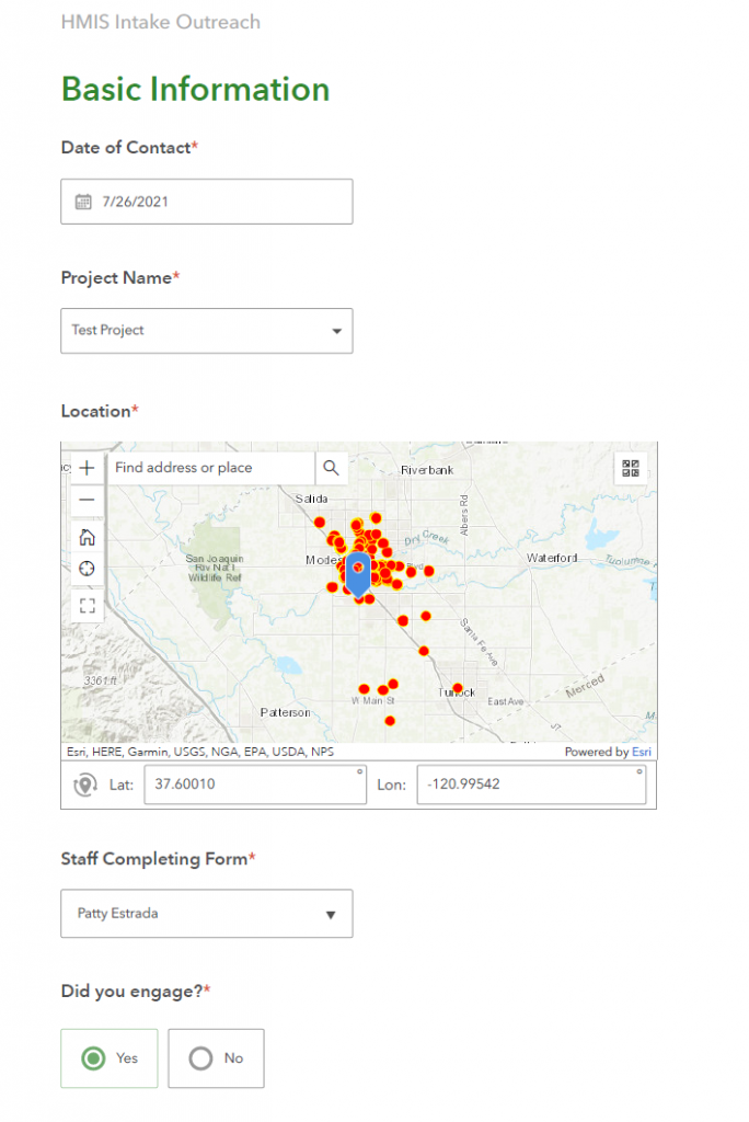
To understand those gaps in the system, city staff are now relying on real-time location-based information. They upgraded from cumbersome paper forms to mobile apps for gathering information from people staying in encampments and shared live maps for interagency coordination. Response teams can now see available shelter beds and other compassionate care as well as where to find people and what they need.
Outreach Gets a Digital Transformation
The city of Modesto has received nearly $4 million in 2020 from the CARES Act to address homelessness. And leaders used this as an opportunity to expand their Homeless Engagement and Response Team (HEART).
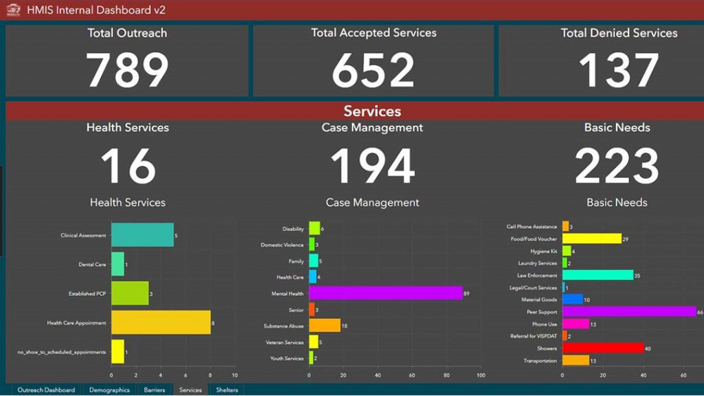
For the HEART program to reach more people experiencing homelessness, the city sought current information by way of a robust data collection tool. They leveraged a set of geographic information system (GIS) maps and apps — a move that digitally transformed outreach efforts. At the same time, the technology helped the city make reports to meet federal compliance requirements.
Most importantly, Modesto outreach teams use the GIS tools to respond to residents where they are and with what they need. This means providing vital resources or intervention and connecting people to other social service programs — all with new levels of speed and precision.
Faster Response to Residents’ Needs
Before switching to smart maps and real-time apps, the work of HEART outreach teams tended to be tedious. Staff would have to gather and record information by hand, then manually input it to be compiled, analyzed and exported. Beyond slowing services to residents, the outdated approach affected data quality.
Now, what used to take up to 20 minutes can be done in a few seconds with clicks on smartphones, tablets and laptops. Information is collected on a customized survey, tracked by location, then presented in a user-friendly dashboard on a single screen. The new approach enhances coordination and communication with shelters and other service providers.
Modesto city manager Joe Lopez noted the new applications and streamlined workflows have empowered HEART mobile teams to deliver services faster and more comprehensively.
“The goal of this new system is to have a better understanding of the needs of this vulnerable population and get them to the right resource to help them be successful,” he said. “We continue to be diligent in analyzing the relevant data to help these individuals move off the streets and into shelters, employment, and then to permanent housing.”
Christopher Thomas is the director of government markets at Esri and a founding team member of the Industry Marketing Department. Prior to joining Esri in 1997, he was the first GIS coordinator for the city of Ontario, California. Thomas frequently writes articles on the use of GIS by government. Follow him on Twitter @GIS_Advocate.
To learn more about how local governments can use GIS to reduce and mitigate homelessness in communities, visit esri.com/en-us/industries/housing-homelessness/strategies/homelessness-mitigation.


Leave a Reply
You must be logged in to post a comment.