

When average property values in Tippecanoe County, Indiana recently showed a ten-year appreciation of over 50 percent, residents were concerned their property taxes would rise. James Werner, Tippecanoe County senior deputy assessor, was worried too. Higher property taxes often lead to more homeowners and business owners appealing their property value assessments.
![]()
In response, Werner and his team at the Tippecanoe County Assessor’s Office made their processes and assessments more transparent. They built a community website to host maps, apps, and data about home values and other location-based information. The site keeps residents informed about how the county conducts property tax assessments, increasing confidence in the decisions. As a result, the county reduced appeals, protecting over $3 million in revenue.
Public Hub Site Provides Transparency
In Tippecanoe County, property tax revenue is used to fund county operations such as public schools, transportation, infrastructure, and other much-needed services. This makes the reduction in appeals all the more valuable to the county government’s bottom line.
“Districts in our state have suffered serious losses due to not being able to defend property value…or are inundated with huge numbers of residential appeals which can add up and create staffing challenges,” Werner said.
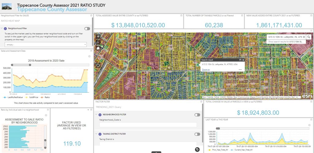
The assessor’s office started its transparency effort by collecting data from the interactive, online geographic information system (GIS) portal known as Beacon. This resource for local governments shows city and county records. Staff gathered public data from Beacon, including information about current sales of comparable homes and data on amenities such as parks, schools, and churches, which often increase home prices.
County staff integrated information from Beacon into their new site, called Tippecanoe County GIS HUB community. There, residents could visualize their property value assessments and see information about how the assessments were made. So far, it’s been a success.
“Due to the transparency GIS provides, we have reduced our filed tax appeals to about 1 percent of our parcels or about 650 appeals a year, down from nearly 1,200,” Werner said.
Werner noted that clear communication with the public, using maps to illustrate how the county calculated assessments, helped residents understand how the assessor’s office had reached fair property market values. Officials now can help residents and property owners understand their resulting taxes and what public services they should expect to receive in exchange.
Location Data Provides Context for Decisions
Accessible maps with accurate data not only enable Tippecanoe County to better defend decisions to the community, but officials also can more easily provide assessment information to tax review boards when they need evidence.
Building on its success with the hub community website, the county created a new GIS-based tool that auto-populates tax appeal forms. It takes data from the hub site, such as building permits, traffic, elevation, zoning, proximity to utilities and transportation, flood risk, and noise from railroads, highways, and aviation. By instantly integrating the information that supports a resident’s case into appeals, the county streamlined the process for both those filing and those reviewing the forms.
Werner and other county officials say they will continue to leverage their GIS technology to support transparency across other departments — including public health, emergency response, and elections.
“I found the system very easy to use,” Werner said. “GIS is no longer a field where the layman user cannot do anything without an expert. The average person can create maps without technicians or consultants.”
Learn more about how GIS can help leaders accurately determine and visualize property values to increase trust with the residents they serve and govern more effectively.
Christopher Thomas is the director of government markets at Esri and a founding team member of the Industry Marketing Department. Prior to joining Esri in 1997, he was the first GIS coordinator for the city of Ontario, California. Thomas frequently writes articles on the use of GIS by government. Follow him on Twitter @GIS_Advocate.


Leave a Reply
You must be logged in to post a comment.