

One of the starkest examples of how the pandemic has reshaped our lives comes from the many people in our communities nationwide who have had to spend countless hours at computers, learning or working from home. The shift has drawn attention to the need for increased and equitable access to broadband internet throughout the United States.
In Dubuque, Iowa, city leaders had a head start.
In 2016, the city introduced its Dubuque Broadband Acceleration Initiative, built from a public-private partnership and $19 million infrastructure investment, to give residents a wider choice of internet providers — from two legacy carriers to 14.
Like many government leaders across the U.S., Dubuque officials wanted to lead with equity. They aimed to understand the benefits and burdens of residents in terms of access to quality broadband services. But first they needed data.
“We recognized early on we would need a comprehensive effort based on data and analytics with multiple funding sources,” said Chris Kohlmann, information services manager for the city of Dubuque.
To capture key data about current service levels, and discover where equity gaps in broadband service existed, Kohlmann enlisted the support of the city’s geographic information systems (GIS) department, led by Nikki Rosemeyer.
Rosemeyer and her team gathered Federal Communications Commission (FCC) data on broadband availability and data from residents that had been collected in the city’s Broadband Services Survey.
The survey asked households across the city about current internet use, speed, bandwidth and need for services. Respondents described how internet service impacts their lives and identified the number of people residing in the housing unit as well as their race, ethnicity and monthly income. All results were anonymous and kept confidential to maintain residents’ privacy.
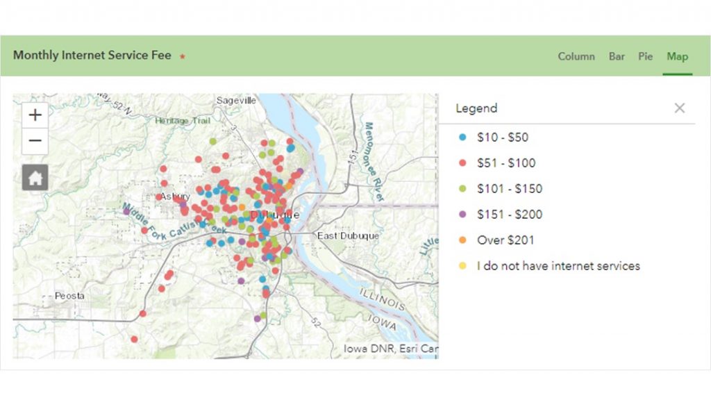
When FCC and resident survey data were layered onto a GIS map, the team could clearly see areas in the city where residents were disproportionately disadvantaged. For example, 30% of survey respondents said they requested faster internet speeds but were told it was not available. The map could show where residents were facing this situation, enabling the city to prioritize its efforts.
“We thought we might know where we needed to dedicate resources. But not until we started to visualize local data sets, survey results, FCC data and demographics did the picture become clear,” Rosemeyer said.
Kohlmann and Rosemeyer were able to identify a project area — one with a high concentration of anchor institutions like parks, schools, churches and youth centers — and apply for grant funding. The GIS analysis enabled the city to propose a project that would result in service provider profit via increased customers and coverage, as well as address community concerns about speed, access, cost and equity.
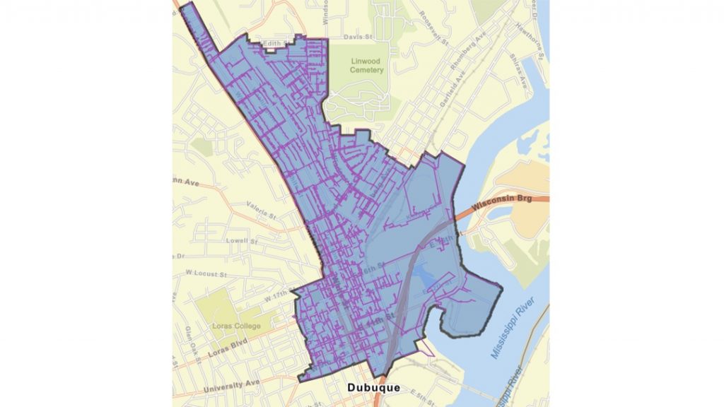
This geographic approach — using maps and geospatial analysis to identify areas of need and secure funding — is now underpinning the city’s broadband efforts.
“On our grant application, we were able to present background on why we picked the specific neighborhood for our project area,” Kohlmann said. “The mapping and analysis allowed us to apply with confidence and compete with larger jurisdictions, with bigger budgets. GIS gives us an advantage to stand apart.”
Christopher Thomas is the director of government markets at Esri and a founding team member of the Industry Marketing Department. Prior to joining Esri in 1997, he was the first GIS coordinator for the city of Ontario, California. Thomas frequently writes articles on the use of GIS by government. Follow him on Twitter @GIS_Advocate.
To learn more about how the geographic approach and GIS can help local governments secure federal funding with compelling data-driven maps, visit esri.com/en-us/federal-funding/overview.
Interested in becoming a Featured Contributor? Email topics you’re interested in covering for GovLoop to [email protected].


Leave a Reply
You must be logged in to post a comment.