Delivering Vaccines Intelligently With Integrated Systems
This video highlights vaccines distribution as a use case for how cloud can help agencies meet complex and pressing challenges.
Learn how state and local government agencies can face overwhelming IT complexity to deliver useful content to the public with artificial intelligence.
Watching this video, you’ll learn how agencies can use historical data to put the right people in the right place at the right time.
In this free, eight-minute course, we’ll discuss need-to-know information about grants in the U.S. and explain how lifecycle grants management and automation can generate more funding for governments across the country.
Government IT departments are largely in charge of acquiring, deploying and managing the many systems that support these new applications and services. But they have challenges of their own including managing increasingly complex IT environments, confronting a growing volume of service requests, and learning new skills and procedures to keep pace with the latest technologies.Read… Read more »
Recently GovLoop spoke with Craig Orgeron, Mississippi’s Chief Information Officer, to find how the state is using GIS to improve services. Mississippi is a predominately rural state where access to bandwidth is incredibly important. The state relied on GIS to map the areas where bandwidth was a problem and ferment the policy conversation about whereRead… Read more »
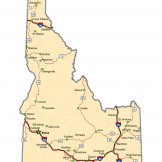
Recently GovLoop spoke with Bill Farnsworth, Idaho Geospatial Information Officer about how Idaho is unlocking its GIS data. The state’s website has used GIS data to map hundreds of miles of hiking trails. They have even mapped GIS data set up a special site to help its State Senators use GIS data effectively. “The StateRead… Read more »
SmarterBetterCities is a web-based tool that allows you to tell stories with your data, and share projects in 3D to help you plan your city. Check out the video below to learn more, or some case studies on the map. For more information on GIS, visit our GIS Resources Hub. When Esri wasRead… Read more »
Our easy-to-use software connects local government, organizations and residents making disaster preparedness and recovery smarter. Watch the video below or learn more by viewing some case studies. For more information on GIS, visit our GIS Resources Hub. When Esri was founded in 1969, it realized even then that geographic information system (GIS) technologyRead… Read more »