
As municipalities aim to eliminate traffic deaths, one issue shouldn’t be overlooked. Curb ramps designed to abide by the Americans with Disabilities Act (ADA) are essential to helping ensure all people can safely cross streets.
In Douglas County, Nebraska, leaders wanted a better way to track ADA-designed curb ramps for maintenance and to prioritize installation. Turning to the geographic information systems (GIS) professionals in Douglas County for help, they found an innovative solution — one that employed artificial intelligence (AI) deep learning models for added efficiency.
“It was our initial attempt at creating a deep learning model from scratch,” said Steve Cacioppo, a senior GIS analyst with the county. “This model provided a time-saving approach to rapidly collecting ADA curb ramps for the City of Omaha.”
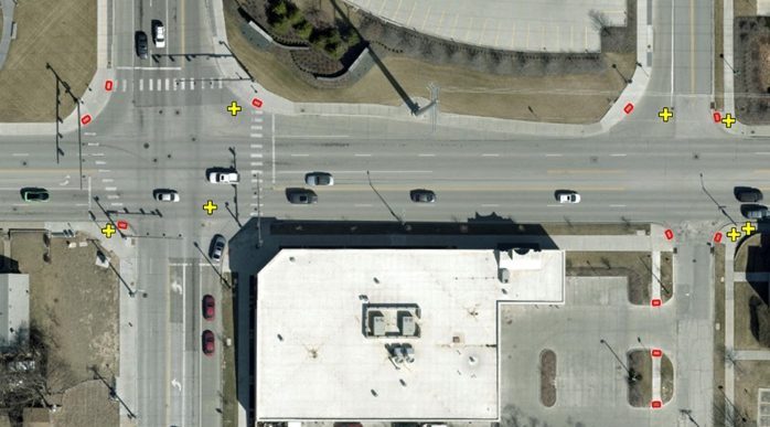
An in-person inventory of every ADA curb ramp would have required too many resources. And pinpointing them with aerial imagery proved to be too time consuming for analysts to do on their own.
Using Geospatial AI to Understand Aerial Imagery
Cacioppo and the county’s GIS group had long embraced a culture of innovation that encouraged learning and applying new technology capabilities. The ADA curb ramp inventory became an ideal opportunity to implement GeoAI, or geospatial artificial intelligence, for extracting features from imagery.
Using ArcGIS Pro, an enterprise-level technology, and the county’s one-inch-resolution digital aerial imagery in a mosaic dataset, the team worked through different scenarios. They narrowed the focus of the model to only areas where intersections and ramps are located, including multifamily housing and commercial areas. The county also avoided analyzing areas without sidewalks since an ADA curb ramp needs a sidewalk.
Some ramps were not initially detected because they were lost in shadows in the aerial imagery or confused with car sunroofs — but these issues were minor and correctable.
A Time-Saving Model
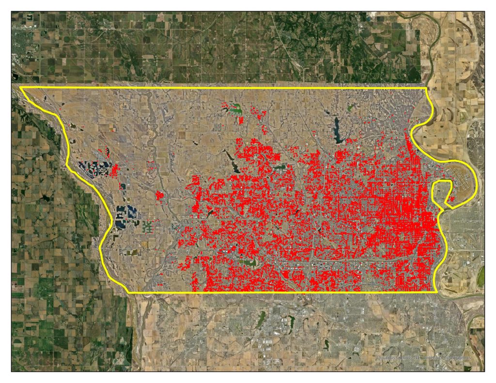
When the model was finalized, it identified 34,183 ADA-designed curb ramps — more than twice what the city had recorded in its original inventory.
The model’s efficiency has been substantial, too. On average, it had taken county staff one to two minutes to add a single ramp into GIS. To add all 34,183 ramps, it would have taken anywhere from 23 to 47 days. The GeoAI model, run on a PC using ArcGISPro, identified all the ramps in about 12 days.
“This time-saving model allowed us to shift human labor from this project to other projects that needed more assistance,” said Todd Spark, Omaha’s maintenance superintendent.
With the curb ramp inventory completed, county staff can use GIS to identify and prioritize where new ADA curb ramps are needed. That review could include looking at the locations that would be most equitable for the community based on an ArcGIS Solutions Social Equity Analysis.
As new aerial imagery is collected every two years, city and county staff can automate updates to the inventory.
Douglas County officials and the GIS team are looking at additional ways to apply GeoAI tools, including feature extraction of swimming pools for property appraisal and for health department inspections. County staff also want to apply GeoAI to lidar imagery data to glean information about tree cover or detect the edges of pavement, much like they extracted information about the curb ramps.
Learn more about GeoAI and pretrained deep learning tools available from the ArcGIS Living Atlas of the World.
Christopher Thomas is the director of government markets at Esri and a founding team member of the Industry Marketing Department. Prior to joining Esri in 1997, he was the first GIS coordinator for the City of Ontario, California. Thomas frequently writes articles on the use of GIS by government.


Leave a Reply
You must be logged in to post a comment.