Creating Connected Transportation Systems in Your Community
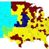
Learn how connected roadways can help city agencies make travel safer, faster, more accessible.

Learn how connected roadways can help city agencies make travel safer, faster, more accessible.
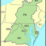
Air pollution is a major threat to our waterways, and it’s especially dangerous to the Chesapeake Bay which is the largest estuary in the United States – 200 miles long from the mouth of the Bay in Virginia Beach, VA to the Susquehanna River near Havre de Grace, MD. The Bay’s watershed includes parts ofRead… Read more »

Recently GovLoop spoke with University of Minnesota students Molly McDonald, Ben Gosack, Chris Martin, Michael Moore, Devon Piernot and Stephen Palka about their Solar Suitability Analysis app– one of Esri’s Climate App Challenge Winners. The app allows homeowners to navigate a heat map to discover if their house is suitable for solar panels. The appRead… Read more »
The Trust for Public Land is a national conservation organization that uses GIS technologies to strategically pinpoint lands that need to be conserved on the landscape. Recently GovLoop spoke with Breece Roberston, National, GIS Director and Jad Daley Director, Climate Conservation Program at the Trust for Public Land – one of Esri’s Climate App ChallengeRead… Read more »

Recently GovLoop spoke with Craig Orgeron, Mississippi’s Chief Information Officer, to find how the state is using GIS to improve services. Mississippi is a predominately rural state where access to bandwidth is incredibly important. The state relied on GIS to map the areas where bandwidth was a problem and ferment the policy conversation about whereRead… Read more »
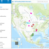
Recently GovLoop spoke with Mike Lockwitz, creator of Flood Forecast – one of Esri’s Climate App Challenge Winners. The app was created in response to the severe flooding in Boulder, Colorado in 2013. The app was developed during a 24-hour hackathon. The app sends users a notification when your property is in imminment danger ofRead… Read more »
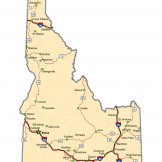
Recently GovLoop spoke with Bill Farnsworth, Idaho Geospatial Information Officer about how Idaho is unlocking its GIS data. The state’s website has used GIS data to map hundreds of miles of hiking trails. They have even mapped GIS data set up a special site to help its State Senators use GIS data effectively. “The StateRead… Read more »
Recently GovLoop spoke with Bryan Jones, GIS Specialist at Gulf Coast Aerial Mapping about how the Postal Service is unlocking the meaning behind their data. “Really what [GIS] has done for our organization is help people understand the meaning behind the data. When you use something like a map people are very interested in it,Read… Read more »
Daniel Visone, Systems & Acquisition Support Directorate Chief, US Army Geospatial Center, recently spoke with GovLoop about how GIS is helping to create a common operating picture. “One of the terms I usually use when I go out brief is that a lot of the army programs are considered stovepipes or cylinders of excellence becauseRead… Read more »
FireWhat is a GIS and technology company that was created to map emergency incidents and create new technologies to track responders and assets in and out of the field. Learn more by checking out the video below and some case studies to the right. For more information on GIS, visit our GIS Resources Hub.Read… Read more »

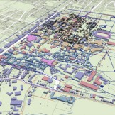
SmarterBetterCities is a web-based tool that allows you to tell stories with your data, and share projects in 3D to help you plan your city. Check out the video below to learn more, or some case studies on the map. For more information on GIS, visit our GIS Resources Hub. When Esri wasRead… Read more »
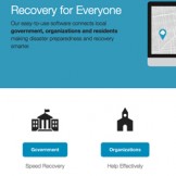
Our easy-to-use software connects local government, organizations and residents making disaster preparedness and recovery smarter. Watch the video below or learn more by viewing some case studies. For more information on GIS, visit our GIS Resources Hub. When Esri was founded in 1969, it realized even then that geographic information system (GIS) technologyRead… Read more »

StreetCred Software was founded by two Texas police officers who were looking to re-imagine law enforcement and give officers the tools they needed to combat crime in their community. Watch the video below to learn more, or check out the case studies on the map. For more information on GIS, visit our GIS ResourcesRead… Read more »
GovLoop recently spoke with Peter Noy, Asset Manager, Geospatial Management Office, US, Coast Guard, on how GIS is improving business functions with limited resources. “We are now beginning to take terabytes of information and display in a geospatial way, in the past we have had to look at tons of tabular reports and documents, we can nowRead… Read more »
Valarm supports real time sensor networks and shares data to the cloud all using commodity hardware. One example is using sensors to monitor air quality. The data is shared to the cloud, and allows people to analyze the data and be used for geo-analysis, to help improve decision making. Watch the video below to learnRead… Read more »
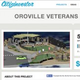
Citizinvestor is a crowdfunding and civic engagement platform for local government projects. Watch the video below to learn how they work, and check out some case studies on the map to the right. For more information on GIS, visit our GIS Resources Hub. When Esri was founded in 1969, it realized evenRead… Read more »

GovLoop interviewed Jerry Johnston, Geographic Information Officer, CIO’s Office, Department of Interior about the GeoPlatform.gov story and the value of sharing geospatial information with a larger audience. Geoplatform.gov is a “one-stop shop” for integrated, federal data via maps.

GovLoop interviewed Bryan Sivak, CTO, Department of Health and Human Services about his work with healthdata.gov and open data. Over the last few years, government agencies have worked to “open up their data.” This means that their datasets can be freely used, reused and redistributed by anyone.

Recently GovLoop caught up with Harvey Simon, Geospatial Intelligence Officer, EPA and Kshemendra Paul, Program Manager, Information Sharing Environment at Esri’s Federal GIS Conference. Be sure to check out the videos below to learn more about geoplatform.gov, the National Strategy for Information Sharing and Safeguarding and how they both are using GIS technology.

In the era of doing more with less, GIS technology has emerged as a way to reduce costs, improve decision-making, and increase communication between teammates, and the public. To showcase some of the great ways agencies are using GIS, Esri and GovLoop put together a series of videos that you can view below. In theseRead… Read more »