Posts Tagged: Esri

Learning At “A Mile A Minute” At Esri FedGIS

It’s finally February, the month of the Esri Federal GIS Conference. Taking place on February 24th and 25th in Washington, D.C., the conference is the perfect opportunity for federal employees to learn about new developments in GIS technology and see how other agencies are using GIS to achieve mission goals. A plenary session on theRead… Read more »

3 Reasons Why You Should Attend the Esri FedGIS Conference

The countdown is on with less than a month until Esri’s Federal GIS Conference in Washington, D.C., taking place on February 24 -25 at the Walter E. Washington Convention Center. Haven’t registered yet? Need some convincing? Here are three reasons why anybody interested in GIS should register now. #1: You’ll further your education The FederalRead… Read more »

Data, Analysis, and Action – Esri’s Federal GIS Conference

In a world where information grows at exponential rates, it can be difficult to figure out what is important, how things are related, and why we should care. But those are exactly the tasks that federal employees must address on a daily basis. Luckily, that’s where geographic information system (GIS) comes in. GIS can helpRead… Read more »

Ummm Can Your Drone Fly Here????

Drones. Those unmanned aerial vehicles (UAVs) that everyone from Modern Family’s Phil Dunphy to the Dalai Lama are taking a turn at piloting. Drones are quickly changing the information landscape with the possibility of being the most highly disruptive technology since the cell phone. They are true robots, tasked by their human masters for all typesRead… Read more »

Maps on Apps and Apps on Maps – GIS Beyond the Office

Long gone are they days where workers are tied to their desks. In fact, people increasingly rely on mobile devices to access information – especially those in field staff positions. Those mobile workers require fast, reliable location-based apps to get their jobs done. But how do you do that effectively? At GovLoop and Esri’s Meet UpRead… Read more »

Esri is Now Adding “Health Guru“ To Its Diverse Resume

Thanks to Esri and their famous GIS platform the state of Virginia and retailer Walgreens are now contributing to the health of their communities. If you weren’t already impressed with the location-based system that lets you discover, connect, share, and apply data for community intervention efforts, wait until you read how ArcGIS helped to createRead… Read more »

Proximity-to-Care: Mapping to Maintain Health and Well-being

Geographic information system (GIS) is back – and we’re not just talking about maps this time. We’re talking about a tool that creates a new vision of health improvements – a data-driven way to visualize and understand the large volumes of data and the allocation of resources needed for healthy communities. So yes, maybe we’reRead… Read more »

Citizens See Crime Minute-By-Minute

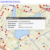
Citizens across the country are increasingly seeing more of their governments utilize open data to develop interactive GIS platforms as the needs to citizens evolve. These platforms, built by Esri, have been successful in helping local governments enhance public engagement with open data to create better public service. Popular platforms such as Open Data MinneapolisRead… Read more »