Why Imagery Analysis Is a Game Changer for Gov
Looking for a way to make meaning from the data in pictures? Check out Esri’s solutions.


Looking for a way to make meaning from the data in pictures? Check out Esri’s solutions.

If you are looking for ways to mitigate waste, fraud and abuse at your agency, GIS may be the answer.

Ready to take your government or military installation to the next level? Check out how you can turn your installation into a smart installation in four easy steps.

GIS services allow for time-saving tactics, smarter decisions and more holistic approaches to comprehending data analytics.
As our government continues the journey of open data and citizen engagement, finding meaningful ways to share that data and encourage interaction will only grow in importance. Maps are just one way to improve our citizens’ customer experience.

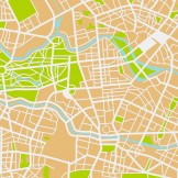
Learn how to get the most out of your imagery with Esri’s imagery analysis solutions.

I would argue that one of the most interesting reasons this election will be viewed as a tipping point is because of the role of technology in making voters’ experiences even better.
Imagery analysis methods like change detection help provide critical data for environmental monitoring and natural resource management. Beach erosion, melting ice caps and forest fires are a few examples of the types of change detection analysis that imagery can support.

We see the explosion of GIS with the advancements in technology. Do you know how often you use GIS?

Leveraging mobile technology can do everything from making your agency’s workforce more efficient to promoting citizen engagement. Check out these tools that can help your agency refine its mobile strategy and implement more efficient and effective processes.