When Tornadoes Hit Tallahassee, AI Maps the Damage in Days, Not Months
Tallahassee – Leon County, Florida, punches above its weight by turning an experiment into a nationally recognized model for municipal AI innovation.


Tallahassee – Leon County, Florida, punches above its weight by turning an experiment into a nationally recognized model for municipal AI innovation.
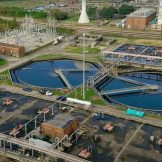
Using GIS along with AI technology, Houston has successfully digitally transformed its public works system for infrastructure management.
Salem, Oregon’s drones-as-a-service program supports multiple city departments, enhancing operations through high-resolution imagery.

Maricopa County needed to identify the most vulnerable areas in the county and promote optimal vaccination sites to the public.

New Jersey’s Department of Environmental Protection saw a surge in harmful algal blooms in lakes and reservoirs so it launched an interactive mapping tool.

Sure, you can designate an outdoor space for use, but how can you ensure that it equitably meets your residents’ needs?

We can all recognize that the role geography plays in executing an effective public health response is critical. Understanding how to apply location-based thinking enhances preparedness and response efforts.

Operational efficiency is one of the four technology tenets of a smart community. It takes many forms, but it essentially involves developing new ways of working that enable agencies to optimize the management and performance of internal operations and constituent services. New workflows can reduce the cost of and time it takes to deliver existingRead… Read more »

Assessing property values in Crawford County, in rural northwestern Pennsylvania, is always a challenge, with only three assessors on staff to cover 51 municipalities.

The AWS partner network supports frontline workers with technology that enables tracking of health care resources, analyzes utilization of resources and more.