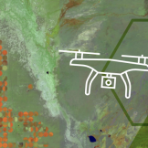
AWS Partner Network Delivers Innovative Solutions for Frontline Workers
The AWS partner network supports frontline workers with technology that enables tracking of health care resources, analyzes utilization of resources and more.
Onondaga County, N.Y., Water Authority began using drone technology to inspect its water tanks, and gathered more information faster and saved costs.
When Hurricane Matthew hit Myrtle Beach, South Carolina, it dumped 10 to 17 inches of rain and generated a storm surge that reached levels not seen since Hurricane Hugo in 1989.
Seattle recently invested in 3D capabilities to visualize the whole city alongside zoning requirements using ArcGIS Urban software
Geographic information system (GIS) software captures and analyzes geographic and spatial data, making it a potentially valuable tool for agencies.
GIS played a vital role in fostering civic engagement and providing an inclusive environment for residents to voice their concerns and to be heard.
The park district’s GIS department moved to a centralized GIS program that replaced the district’s disjointed system of datasets.
In what ways is GIS being used to combat the coronavirus spread? Esri’s Chief Medical Officer outlined five steps GIS responders can take.
Flooding is a recurring threat for the Missouri state park system because many of its parks lie along major rivers. They found a GIS solution that automated and streamlined information to share with stakeholders and the public.
At GovLoop’s online training, industry experts with park agency backgrounds spoke about how GIS can help park agencies maintain and manage smart parks.