Onondaga County Uses GIS and Imagery to Reap Savings
Onondaga County, N.Y., Water Authority began using drone technology to inspect its water tanks, and gathered more information faster and saved costs.

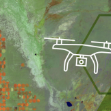
Onondaga County, N.Y., Water Authority began using drone technology to inspect its water tanks, and gathered more information faster and saved costs.

The park district’s GIS department moved to a centralized GIS program that replaced the district’s disjointed system of datasets.
Geographic information system (GIS) technology captures, organizes and analyzes geographic data for public servants trying to improve their communities.
In this post I am discussing geo-enabled enterprises. This spatial indexing of data not only creates a new data element to analyze but also allows the data to be visualized in a very intuitive way; as a map
For decades, OMB and Departments have been trying to trace federal grants and loans to specific places: cities, neighborhoods, farms, enterprise zones, individual houses or stores. The complexity of community development, economic development, rural development, job creation, or just accounting have plagued how funds can be traced. The purpose of tracing the money is toRead… Read more »
After millennia, now most people are drawn to “GPS,” or “Google Maps,” and rely on navigation to drive, to hike, to find a restaurant, to catch fish, and more. Such interest and dependence on geospatial information systems’ data creates a neologism of “a Google Map” or a “GPS Map,” but neither are maps as weRead… Read more »
Esri and GovLoop recently hosted a meetup showcasing how GIS solutions can make it easier than ever before to create online mapping applications. Featured at the event was a case study from Global Forest Watch, which is “a new dynamic online forest monitoring and alert system, designed to empower people everywhere to better manage forests.Read… Read more »