Potter County, PA Used Maps and Data to Bridge the Digital Divide
A rural Pennsylvania community expanded broadband internet services using GIS.


A rural Pennsylvania community expanded broadband internet services using GIS.

Partnerships 4 Success (P4S) is using GIS to map community conditions, analyze geospatial data, inform policy decisions and resource allocation, and disseminate information to address health inequities in San Diego’s South Bay.

Maricopa County needed to identify the most vulnerable areas in the county and promote optimal vaccination sites to the public.

Central data offices across government are outnumbered in staff, time and budget. Here’s what they’re trying to do about it.

To combat the spread of an infectious disease, which requires contact tracing, geospatial information has shown what feet on the ground can’t.

Operational efficiency is one of the four technology tenets of a smart community. It takes many forms, but it essentially involves developing new ways of working that enable agencies to optimize the management and performance of internal operations and constituent services. New workflows can reduce the cost of and time it takes to deliver existingRead… Read more »

The AWS partner network supports frontline workers with technology that enables tracking of health care resources, analyzes utilization of resources and more.
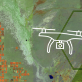
Onondaga County, N.Y., Water Authority began using drone technology to inspect its water tanks, and gathered more information faster and saved costs.

When Hurricane Matthew hit Myrtle Beach, South Carolina, it dumped 10 to 17 inches of rain and generated a storm surge that reached levels not seen since Hurricane Hugo in 1989.

Seattle recently invested in 3D capabilities to visualize the whole city alongside zoning requirements using ArcGIS Urban software