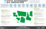
Resources All Case Study E-book Guides Infographics Market Trends Playbook Quick Insights Research Brief Topic Snapshot Worksheet All Acquisition Analytics Artificial Intelligence Big Data Career Citizen Engagement Cloud Communications Cybersecurity Digital Government DoD Emerging Tech Employee Experience GIS GovLoop Spotlight Healthcare Human Resources Innovation IoT IT Modernization Leadership Learning Miscellaneous Mobile Open Data Policy Product Showcase Professional Development Project Management Reading List Social Media State and Local Tech Uncategorized Well-Being Workplace GIS How GIS Drives Innovation Across Outdoor Recreation Spaces GIS How Data-Driven Performance Powers Smart Communities GIS Strengthening Public Health Preparedness With GIS GIS Smart Communities Turn to GIS to Improve Operational Efficiency GIS Imagery Delivers New Insights for Smart Communities GIS Smart Communities: Delivering Intelligent Community Design With GIS GIS Blazing a Trail to Smart Parks With GIS Citizen Engagement Smart Communities Turn to GIS to Achieve Civic Inclusion GIS Creating Connected Transportation Systems in Your Community Cloud Delivering Smart Communities Through a Geospatial Strategy GIS Smarter States Equal Smarter Communities GIS Resilient by Design: Solving What Keeps Community Leaders Up at Night GIS Altering the Course of Disease Surveillance: Connecting Cause and Effect to Location GIS Strengthening Our Nation’s Infrastructure: Improving Decision-Making With Location Intelligence GIS Moving Toward Health Equity Through GIS GIS A Modern Approach to Public Health Preparedness GIS Creating a Real-Time Government with GIS GIS Responding to the Opioid Crisis with GIS GIS Responding to Homelessness in Crisis Mode GIS Putting a Smart Communities Strategy to Work GIS Building a Mobile Government Strategy with GIS GIS Using GIS to Tackle the Opioid Crisis GIS Creating Smart Installations With the Power of GIS GIS Building Healthy Communities with GIS-based Mobile Data Collection GIS Reducing Fraud, Waste and Abuse in the Public Sector using GIS Acquisition Geospatial Analysis: Breaking Down What You Need to Know GIS Story Mapping Environmental Success in the Chesapeake GIS The Informative Power of GIS and Statistics GIS High-Resolution Imagery: Helping City Managers Better Serve Their Communities GIS GIS: The Essential Tool for Smart Communities GIS How GIS Empowers You to Build a Smart Community GIS Building Healthy Communities: Making a Difference With GIS GIS 7 State Government GIS Innovators Analytics People, Places and Process: The Impact of GIS & Facilities Management GIS Leveraging the Power of Open Data and GIS GIS University Uses GIS For Solar App GIS GIS Helps Save the Environment GIS Mississippi Enhances Services with GIS GIS GIS Helps Make Flood Maps GIS Idaho Enhances Collaboration with GIS GIS Laying the Bricks for a Resilient Community GIS GIS: Your Platform for a Resilient Community GIS Unlocking the Meaning in Your Data GIS How GIS is Creating a Common Operating Picture GIS Increasing Collaboration and Civic Engagement Through Open Data GIS Learn How FireWhat Leverages GIS During Emergencies GIS How 3D Mapping is Changing Our City Planning Big Data Open Data and GIS: Better Understanding Our World GIS Building More Resilient Communities with GIS GIS New Tools to Fight Crime GIS Improving Business Functions With Limited Resources GIS Sharing Sensor Data for Smart Decision Making GIS How GIS Helped Secure Super Bowl XLVIII GIS A New Civic Engagement Platform: Crowdfunding Communications Creating a Stronger Democracy: GIS on Capitol Hill GIS Put Your Agency On The Map GIS GeoPlatform.gov: Their Story GIS Open Data in Government: Past, Present and Future Communications The Mapping Revolution: Incorporating Geographic Information Systems in Government Communications Exploring the Power of GIS for Facilities Management GIS GIS Interviews: Geoplatform.gov and the National Strategy for Information Sharing Communications ArcGIS as a Platform: Interview with Esri President Communications How GIS Influences Our Daily Lives GIS GIS in Action Communications Identifying the Promise of GIS for Government Communications State of Government Government Communications